How can Automatic Identification System (AIS) data be used for maritime spatial planning?
How can Automatic Identification System (AIS) data be used for maritime spatial planning?
Résumé
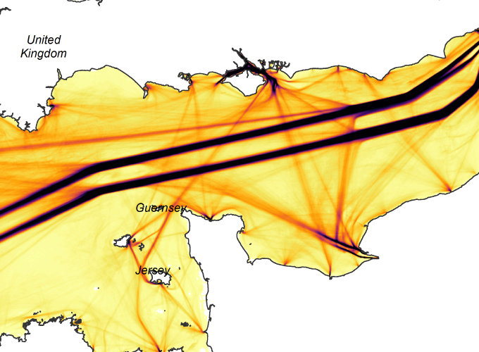
Although the importance of Maritime Spatial Planning (MSP) as a concept is know acknowledged and the legal framework is in place, the task of applying it remains a delicate one. One of the keys to success is having pertinent data. Knowing how maritime uses unfold in a spatio-temporal context, and what conflicting or synergistic interactions exist between activities, is crucial. However, this information is especially hard to obtain in a marine environment. As a result this information has often been identified as the missing layer in information systems developed by maritime stakeholders. Since 2002, the Automatic Identification System (AIS) has been undergoing a major development. Allowing for real time geo-tracking and identification for equipped vessels, the data that issues from AIS data promises to map and describe certain marine human activities. After recapitulating the main characteristics of AIS and the data it provides, this article proposes to evaluate how AIS is currently used in MSP at a European level, and to concisely present a series of methods and results obtained within the framework of several operational research projects. The objective is to illustrate how the AIS data processing and analysis can produce adequate information for MSP: maritime traffic density, shipping lanes and navigation flows, hierarchical network of maritime routes, alleged fishing zones, spatio-temporal interactions between activities (potential conflicting uses or synergies). The conclusion looks in particular at the legal questions concerning the use of AIS.