Human activities in bay of Brest: models and simulations
Grant: LITEAU III (MEDDTL/CNRS:L.3-0006618)
Duration: 3 years (2009-2012)
Summary: The Rad2Brest project aims at modeling the interactions between human activities in a multifunctional maritime basin. We use modeling as a conceptual framework adapted to the understanding of complex biophysical and social systems and a tool facilitating the exchange of points of view and the sharing of knowledge between local stakeholders such as fishermen, administrators and researchers. Due to its physical and anthropogenic components and to its stakes, the bay of Brest is chosen as the study site.
Firstly the evaluation of marine ecosystem service is based on expert knowledge. For the Millennium Ecosystem Assessment categories of ecosystem service, several ecological indicators are selected, and the cost of the compensatory measures required to fulfill the goal of no net loss is assessed using the Habitat Equivalency Analysis. The results of this analysis highlight differences between compensatory measures and their associated costs depending on the category of ecosystem services targeted.
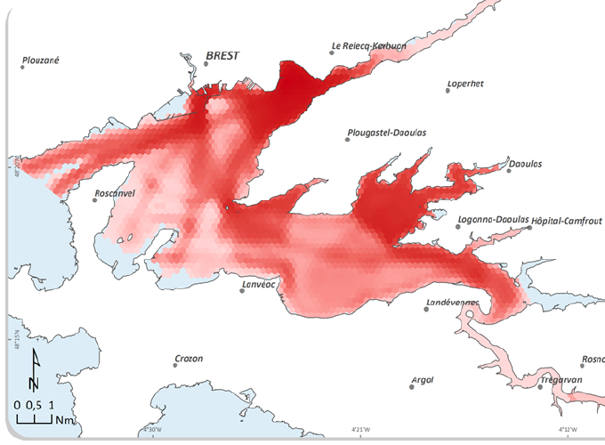
Secondly a detailed typology of the whole maritime activities settled in bay of Brest (51 activities) is produced and spatial, temporal, quantitative and qualitative data acquisition combines both analysis of spatio-temporal databases and results from interviews with stakeholders. The GIS-based capture data is well managed by the stakeholders who are interested in contributing to the process of gathering scientific data. The heterogeneous data collected are stored in a spatio-temporal database (STDB). First, the STDB is used with a GIS to produce temporal snapshots of daily human activities patterns within a year. Secondly, the STBD enables to identify, quantify and map potential uses conflicts for both space and time between activities in the bay of Brest. The results of a participatory workshop with stakeholders show that the dynamic component of the data brings a real value for management. The possibility to use the dynamic GIS to discuss and simulate management scenarios is tested but requires a gradually built-up.
Thirdly a focus deals with the dredging activities. Cognitive maps are used to express individual’s judgments, thinking or beliefs about the activity. A multi-agent system is used to model the activity, its relationships with marine habitats. Prospects of the project include the transfer of the STBD as an operational planning support, its coupling with dynamic models of benthic resources, the updating of the human activities database by the Long Term Ecological Research network ( Zone Atelier Brest-Iroise) and the study of the use of geographic information in the Integrated Coastal Zone Management process.
